Sidebar

Great Waters Challenge 2016
The Great Waters Challenge #1
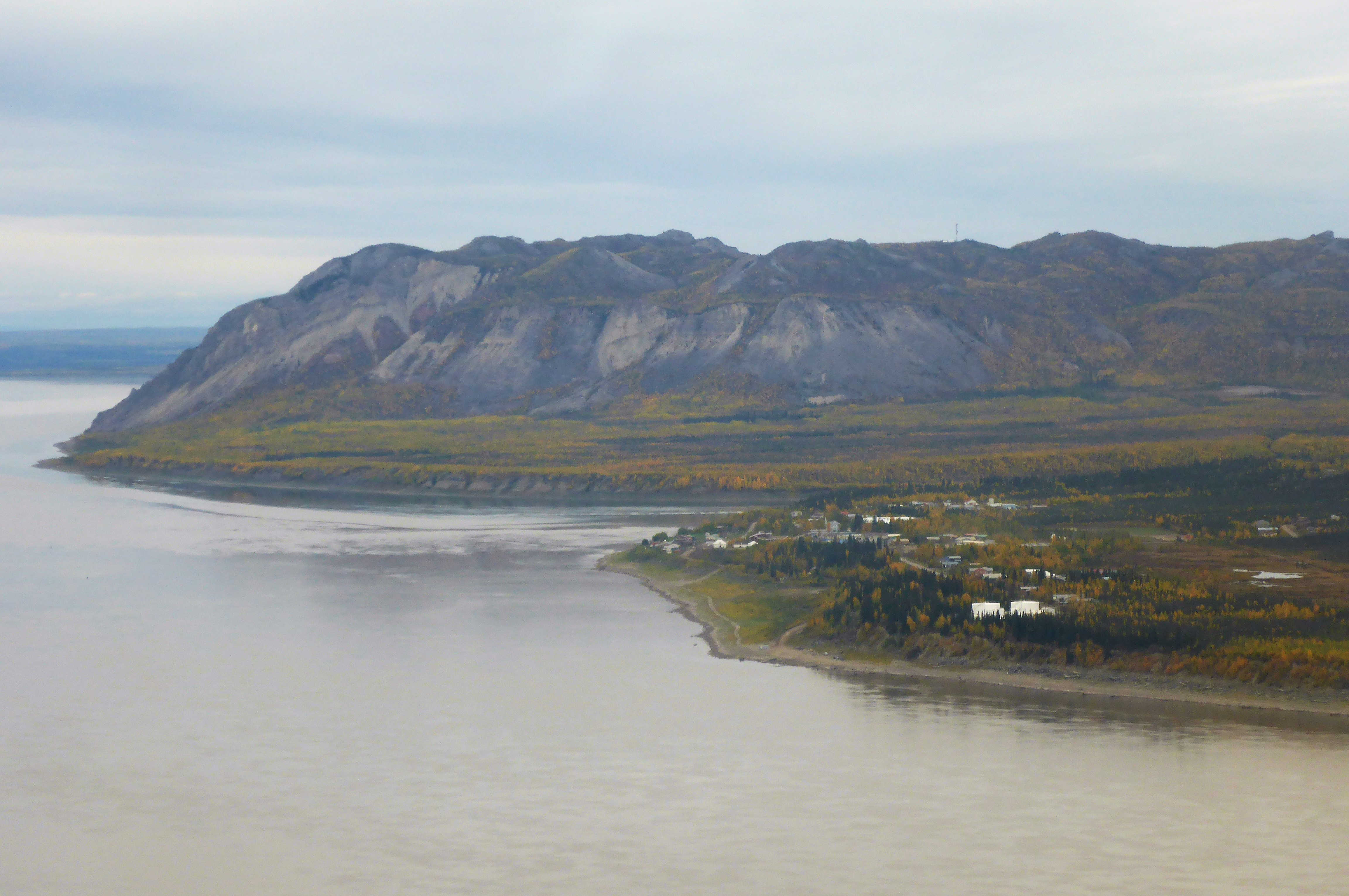
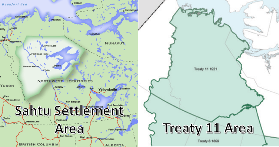
This past summer, I decided that it was time for a change of scenery after six years in Vancouver, so I took a job with Parks Canada and headed north. I moved up to Tulita (the Dene name for “where the waters meet”), which is located at the confluence of the Deh Cho (Mackenzie) and Sahtúdé (Great Bear) rivers. Tulita is a small hamlet of around 500 people and is accessible by aircraft only for most of the year. It is located in the traditional territory of the Sahtu Dene, which is located within the Treaty 11 area.
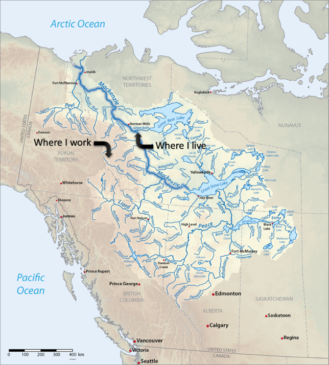
 My job involves monitoring the ecological integrity of a new national park, including measuring the health of freshwater streams. The park is located in the South Nahanni watershed, which is part of the larger Mackenzie River watershed.
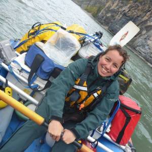
← Faye paddling down the South Nahanni River
The Mackenzie River watershed is the largest in Canada. It encompasses 20% of the country, but only about 1% of the population. Due to its remoteness, the Mackenzie watershed is relatively ecologically intact, as it doesn’t have the same burden of population- and agriculture-related impacts as many other watersheds in Canada. It does, however, contain extensive natural resource potential, including mineral and oil and gas reserves. Much of that potential remains untapped due to transportation constraints, but the watershed does include the Athabasca oil sands in its southern reaches, which threatens downstream water quality. Climate change is also anticipated to have major effects on the watershed, from changing flow levels to increasing access (and therefore natural resource development) from the Arctic Ocean to the expansion of new species into the watershed.
The Great Waters Challenge #2
The Mackenzie River is the longest river system in Canada (10th longest in the world), running 4,241 km from Northern British Columbia via the Great Slave Lake to the Arctic Ocean. The river discharges more than 325 cubic kilometres of water each year, accounting for roughly 11% of the total river flow into the Arctic Ocean. The entire main stem of the Mackenzie River is undammed, although there are some large dams in the upstream tributaries, such as the W.A.C. Bennett and Peace Canyon Dams, and the proposed Site C Dam.
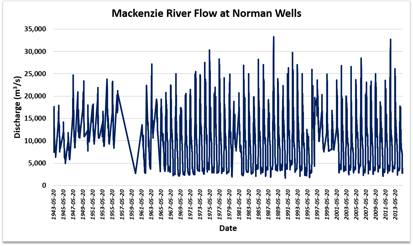
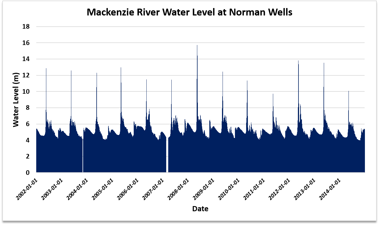
The Government of Canada Water Office has records of the daily flow rates on the Mackenzie River at Norman Wells (90km downstream from Tulita) since 1943 and water levels since 2002, which I have graphed below.
Let’s zoom in onto one year to get a closer look.

The ice break-up on the Mackenzie occurs in May, with peak flow between May-July. Water levels peak sharply in May for a brief period of time.
The South Nahanni River follows a similar pattern.
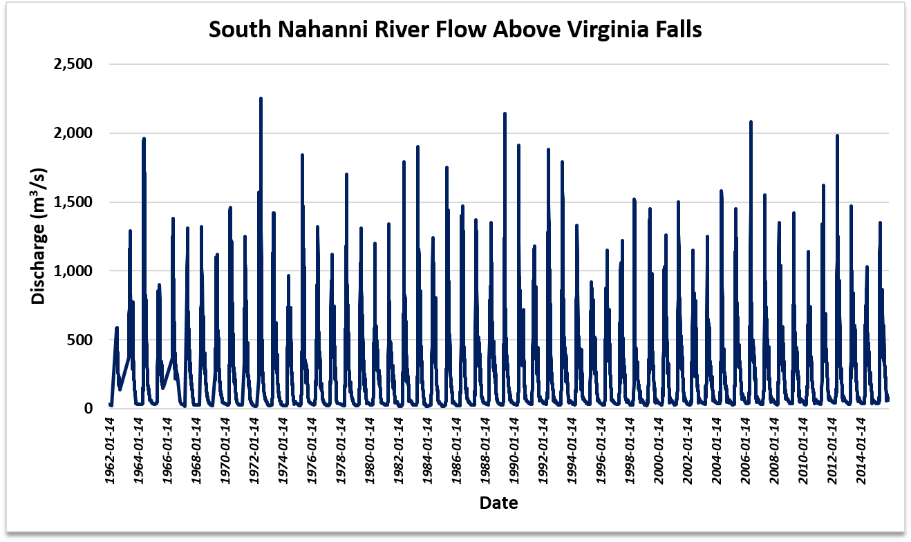
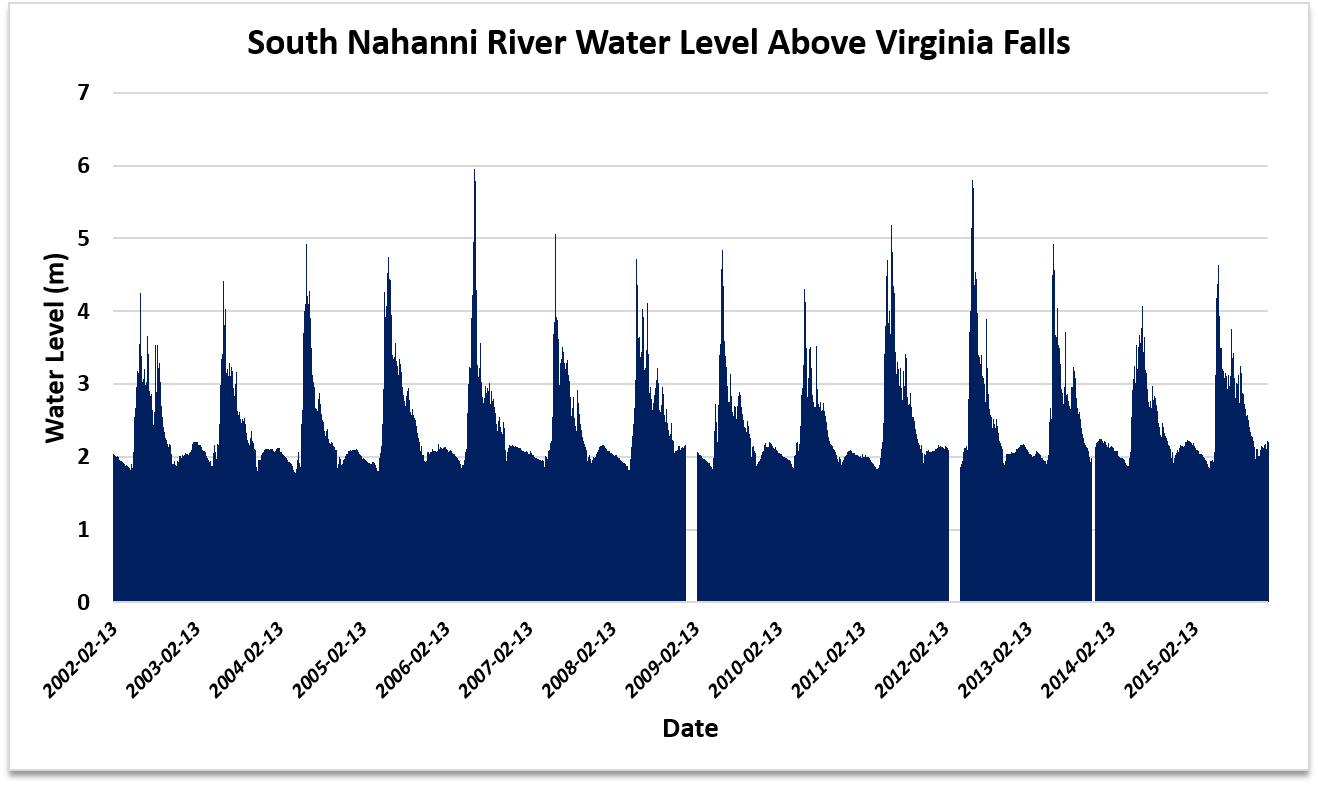
Annual fluctuations in discharge rates and water levels have remained fairly consistent over the period of record. This might change in the future under different climate change scenarios and with the construction of additional dams.
Over 50 species of fish are found in the river (none of them endemic), including northern pike, arctic grayling, burbot, lake whitefish, inconnu, long-nose suckers, and walleye. The river is also an important travel and breeding area for many species of migratory birds. Warming temperatures may increase the number of species able to access and survive in the Mackenzie River. There appears to be an increase in the number of salmon in the Mackenzie River.
Further reading:
The Great Waters Challenge #3
I didn't have time to organize an event, but here are some photos of the Mackenzie River in the process of freezing. It froze over completely on November 23rd. The weather is around -25°C these days. Maybe next year I'll take more regular photos from the same spot to make a timelapse.
 August 7, 2:25pm
 October 29, 5:17pm
 November 8, 6:10pm
 November 21, 3:08pm
The Great Waters Challenge #4
I was excited to see that another Northern team was in the Great Waters Challenge. I thought their post about the discovery of ships from the Franklin Expedition was interesting - at Parks Canada, we hear a lot about the Franklin Expedition archaeological missions. It looks like the ship in the photos is the CCGS Amundsen?
I found these CBC articles on the discovery of the ships - both mention Louie Kamookak:
For the other bloggers down South… it looks so warm where you are! For those of you on Lake Ontario, it looks like you have plenty of shipwrecks where you are too.